LiDAR technology has changed the way we map the world and guide machines through complex environments. From self-driving cars to urban planning, it creates accurate 3D views of reality. Yet, traditional systems often struggle with moving objects and real-time performance.
A new approach, called Lidarmos, is pushing the boundaries. By combining LiDAR with moving object segmentation and faster data processing, it delivers sharper insights and safer navigation. This article explores how it works, where it’s being used, and why it matters for the future of automation.
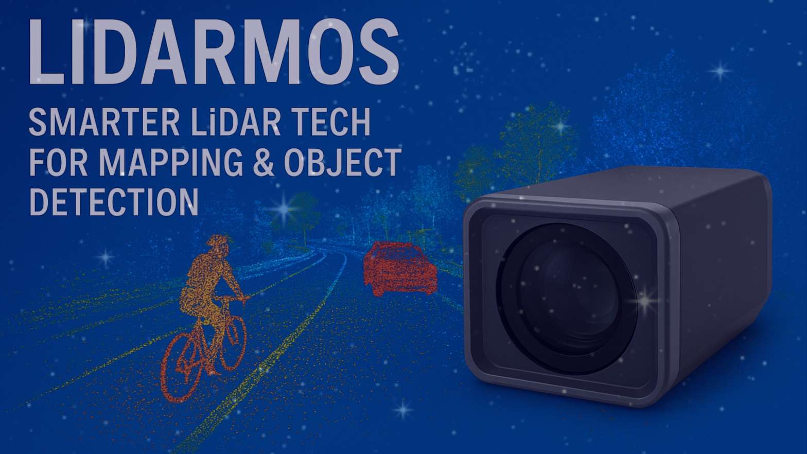
What is Lidarmos?
At its core, Lidarmos is an evolution of LiDAR-based mapping designed for dynamic environments. Standard laser scanners excel at static landscapes, but challenges appear when people, cars, or animals move across the field of view. This system tackles the issue by separating motion from the background in real time.
That precision makes it valuable in industries like autonomous driving, surveying, environmental monitoring, and smart infrastructure.
How the Technology Works
To understand its impact, it’s important to look at how this new form of LiDAR technology functions. It combines laser-based distance measurement with intelligent segmentation and quick data filtering.
Core Components
- LiDAR pulses measure distances and form 3D point clouds.
- Moving object segmentation separates people, vehicles, and other dynamic objects.
- Data processing tools filter noise and classify objects instantly.
Workflow in Action
- Laser sensors capture millions of points.
- Software cleans up the noise for clarity.
- Objects are segmented, labeled, and delivered in real time for immediate decisions.
Key Features
What makes this technology stand out is its accuracy and speed.
Precision Mapping
- Generates high-resolution 3D maps.
- Detects static and moving objects clearly.
Real-Time Decision Making
- Processes large datasets quickly.
- Helps autonomous systems act on instant information.
Flexible Use
- Works with drones, cars, and fixed units.
- Integrates with GIS and cloud platforms for broader applications.
Applications Across Industries
The potential uses for advanced LiDAR mapping go far beyond transportation.
Autonomous Vehicles and Robotics
- Enables safer navigation in crowded spaces.
- Detects potential hazards within seconds.
Environmental Monitoring
- Tracks wildlife movements and migration.
- Maps coastlines, forests, and fragile ecosystems.
Smart Cities and Urban Planning
- Improves traffic flow analysis.
- Enhances pedestrian safety and infrastructure monitoring.
Surveying and Construction
- Provides detailed terrain models.
- Helps detect site changes for better planning.
Benefits Over Traditional Systems
Compared with conventional scanning, this new approach offers:
- Better efficiency in processing large datasets.
- Stronger accuracy in real-time object detection.
- Reduced need for manual adjustments.
- Lower costs over time thanks to faster workflows.
Challenges and Limitations
Like all technologies, it isn’t without drawbacks:
- Sensitive to weather conditions like fog or rain.
- Hardware remains costly for many industries.
- Data-heavy systems require robust computing power.
- Energy demand is higher for mobile units.
Future Outlook
The road ahead looks promising as precision sensing continues to improve. Paired with IoT networks and 5G connectivity, it could reshape smart cities and autonomous navigation. Advances in deep learning will also make segmentation even faster and more reliable.
Conclusion
Lidarmos represents a significant step forward in the evolution of LiDAR technology. By blending accurate 3D mapping with moving object segmentation and real-time processing, it brings safer, smarter solutions to industries ranging from transportation to construction. While challenges remain, its role in shaping future automation and mapping systems is undeniable.